SCHOOL ZONING
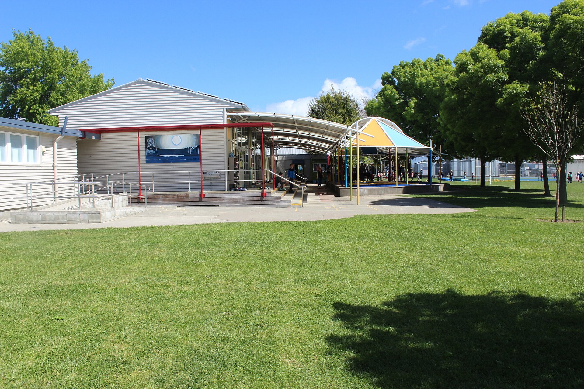
Renwick School (2978)
Enrolment Scheme
Commences 1 January 2024
The guidelines for development and operation of enrolment schemes are issued under Schedule 20, Clause 3 (3) of the Education and Training Act 2020 for the purpose of describing the basis on which the Secretary’s powers in relation to enrolment schemes will be exercised.
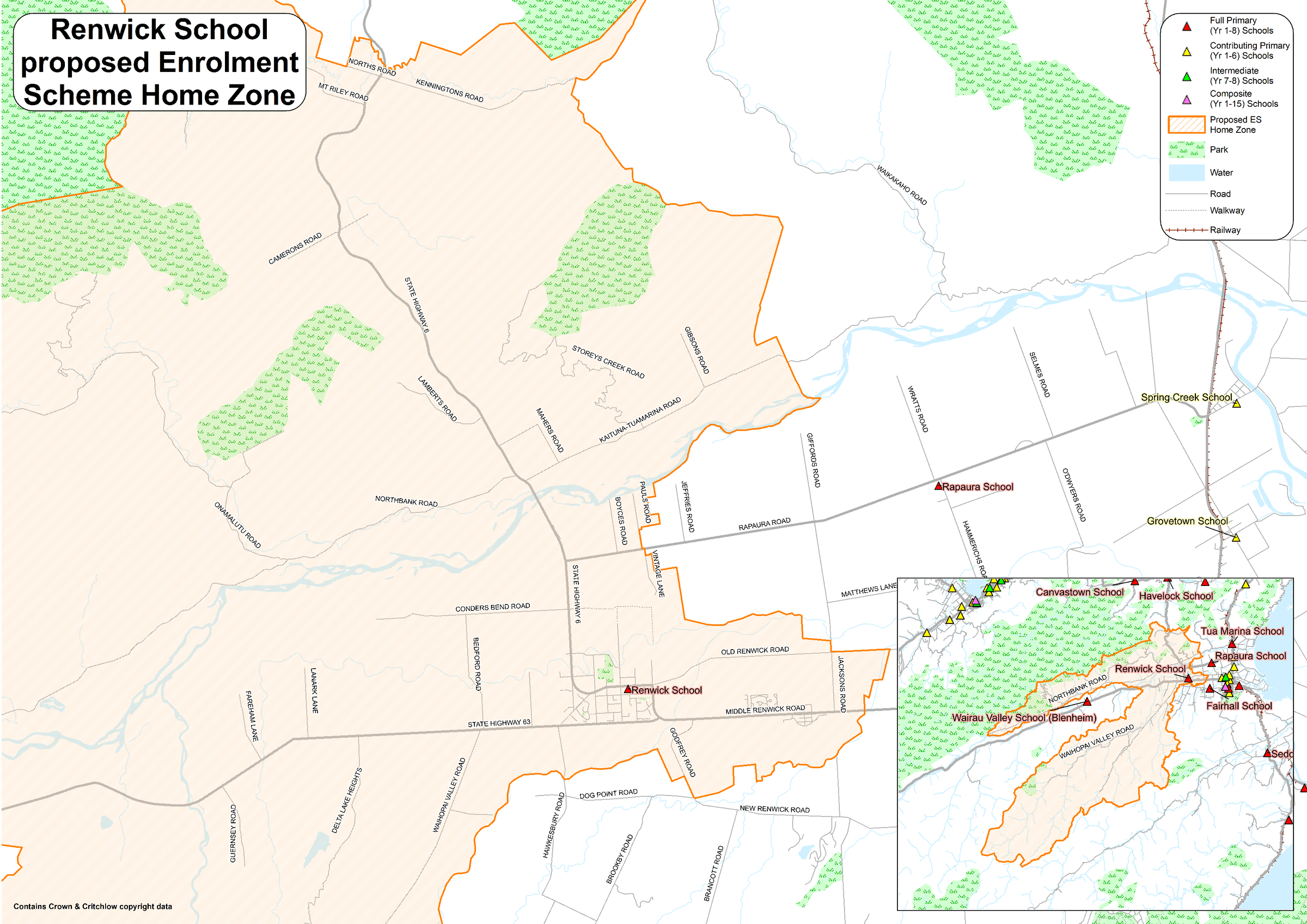
Home Zone
All students who live within the home zone described below shall be eligible to enrol at the school.
The Home Zone includes addresses on both sides of the boundary roads mentioned in the description unless otherwise stated.
Starting from the intersection of Middle Renwick Road and Jacksons Road, the home zone follows:
• West along Middle Renwick Road until State Highway 63
o Including Tancred Crenscent and all the side streets off of it,
o And including Godfrey Road
• West along State Highway 63 up until and including 1326 State Highway 63
o Including Hawkesbury Road between State Highway 63 and Dog Point Road,
o Including Waihopai Valley Road and all the side streets off it,
o Including Delta Lake Heights,
o And including Guernsey Road
• East back along State Highway 63 until Bedford Road
o Including Fareham Lane,
o And including Lanark Lane
• North along Bedford Road until Conders Bend Road
• East along Conders Bend Road until State Highway 6
o Including Conders Bend Road to the west of Bedford Road
• North along State Highway 6 until Norths Road
o Including North Bank Road and all the side streets off it,
o Including Lamberts Road,
o Including Camerons Road,
o Including Mt Riley Road,
o And including Norths Road
• South back along State Highway 6 until Mahers Road
o Including Kenningtons Road,
o Including Leslies Road,
• North-east along Mahers Road until Kaituna-Tuamarina Road
• North-east along Kaituna Road until and including 958 Kaituna-Tuamarina Road
o Including Storeys Creek Road
o Including Gibsons Road
• South-west back along Kaituna-Tuamarina Road until State Highway 6
• South-east along State Highway 6 until Blicks Road
o Including Rapaura Road between State Highway 6 and Vintage Lane,
o Including Boyces Road,
o Including Pauls Road,
o And including Vintage Lane
• East along Blicks Road until Alma Street North
o Including Foxs Island Road
• South along Alma Street North until Oudenarde Street,
o Including Alma Street North to the north of Blicks Road
• East along Oudenarde Street until Brook Street
• South along Brook Street until High Street
o Including Brook Street North
• East along High Street until Old Renwick Road
• East along Old Renwick Road until Jacksons Road
o Including Pak Lims Road
• South along Jacksons Road until Middle Renwick Road
o Including the southern side of Old Renwick Road between Jacksons Road and Burnside Avenue
Each year, applications for enrolment in the following year from in-zone students will be sought by a date that will be published by public notice in a medium appropriate to the area served by the school. This will enable the board to assess the number of places that can be made available to students who live outside the home zone.
Special Programmes
This priority category is not applicable at this school because the school does not run a Special programme approved by the Secretary.
Additional Entitlement to Enrol (Grandparenting)
For families of currently enrolled students whose addresses become out of zone as a result of the amendment to this Enrolment Scheme.
Section 75 of the Education and Training Act 2020 states that; “the Secretary may authorise an enrolment scheme to permit a student to enrol at the
school as if the student lived in the home zone of the school if, -
(a) in the case of an existing enrolment scheme whose home zone is amended, —
(i) the student lives outside the amended home zone; and
(ii) the student has a sibling who is enrolled at the school at the time that the amendment is implemented; and
(iii)the sibling, at the time that the amendment is implemented, lives inside the home zone as it was before the amendment; and
(iv)the student, at the time of enrolment, lives inside the home zone as it was before the amendment:
The Transitional arrangements (“Grandparenting”) section within the Guidelines for the development and operation of enrolment schemes for State Schools further clarifies that in order to enrol as if the student lived in the home zone:
(i) The sibling must also still be enrolled at the school at the time that the student wants to enrol
If applying for enrolment under this part of the Enrolment Scheme, the sibling’s name and evidence of a sibling relationship may be required by the school.
Section 75 of the Education and Training Act 2020 sets out the definition of a “sibling” for these purposes.
The school will maintain a list of students enrolled at the time of the implementation of the enrolment scheme change by the Board in order to enable determination of eligibility to enrol under this provision.
Note: That this is a very tightly defined definition. It would not apply to:
1. Children who move into the withdrawal area after the implementation of the enrolment scheme boundary amendment; or
2. Children of families/whānau who move out of the old zone after the implementation of the enrolment scheme boundary amendment.
Out of Zone Enrolments
Each year the School Board will determine the number of places which are likely to be available in the following enrolment period(s) for the enrolment of students who live outside the home zone. The Board will publish this information by public notice in a medium appropriate to the area served by the school. The notice will indicate how applications are to be made and will specify a date by which all applications must be received.
Applications for enrolments will be processed in the following order of priority:
First Priority This priority is not applicable at this school because the school does not run a special programme approved by the Secretary
for Education.
Second Priority will be given to applicants who are siblings of current students.
Third Priority will be given to applicants who are siblings of former students.
Fourth Priority will be given to any applicant who is a child of a former student of the school.
Fifth Priority will be given to any applicant who is either a child of an employee of the board of the school or a child of a member of the board of the school.
Sixth Priority will be given to all other applicants.
If there are more applicants in any priority groups than there are places available, selection within the priority group will be by ballot conducted in accordance with instructions by the Secretary, under Schedule 20, Clause 3 (1) of the Education and Training Act 2020. Parents will be informed of the date of any ballot by public notice in a medium appropriate to the area served by the school.
Applicants may be required to give proof of In Zone address, or proof to support their application if seeking enrolment under the Out of Zone priorities.
USEFUL LINKS
MORE LINKS
KEEP UP WITH SCHOOL NEWS
Contact the school office to be added to our weekly newsletter distribution list, and sign up to the Linc-ed HERO app